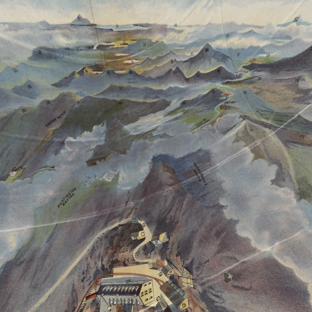
Old maps digitally transformed into 360° virtual panoramas, like this c. 1902 circular bird’s-eye map of Mt. Washington made into a VR view from the summit
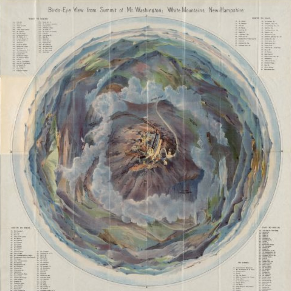
Old maps digitally transformed into 360° virtual panoramas, like this c. 1902 circular bird’s-eye map of Mt. Washington made into a VR view from the summit